The northern migration is winding down, but there's still news to know about the Little River Swing bridge, the dredging of Lockwoods Folly, a new water level gauge for the famous Wilkerson Bridge, and the opening of the Dismal Swamp Canal.
MM 321.5 Little River Swing Bridge. For several weeks, the bridge did not open between 7:00 – 9:00 am and from 4:00 – 6:00 pm on weekdays, causing a dangerous situation in the high-current area by the bridge. After alerting Coast Guard HQS to the variance, the bridge is now honoring the Local Notice to Mariners schedule as follows:
- On Monday through Friday, the bridge will open on the hour and half hour from 7:00 am to 9:00 am and from 4:00 pm to 6:00 pm. The bridge will open on request at other times.
- On weekends and federal holidays, the bridge will open on request.
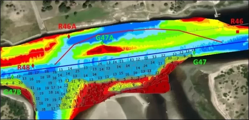
MM 321.5 Lockwoods Folly has been dredged; however, the buoys will not be relocated to mark the newly dredged channel. The path through Lockwoods Folly alternates between the straight-through route and the shore route with regularity, requiring the relocation of buoys with every shoaling event.
I received an advanced chart after dredging from the Coast Guard, which shows the buoys in their new locations (see photo). You'll notice that G47A remains to mark the shore route. If you're aware of the dredging being completed, you can run along the G47B to G47 line and find the dredged channel for 12 to 14 MLLW - or follow the revised Bob423 track in blue.
Note: the new survey is not yet in Aqua Map, and even the Wilmington USACE site with surveys is incorrect for buoy placement. The attached chart is the only one showing both the new dredged path and the present placement of buoys. Since the buoys will not be moved, I changed the shore route to a red dotted line to be used in the future when the straight-through route is once again shoaled.
Note the location of G47A, It marks the remaining shoal that has to be avoided when taking the shore route. In past dredging events, G47A was eliminated and R46A was moved to mark the northern edge of the dredged channel - but not this time, nor in the future. R46A will remain where it is to mark the shore route.
The simple way to find the dredged route is to follow the Bob423 track in blue dated 051125 or later. When the straight-through route shoals again (it will!), the shore route will already be marked in Aqua Map or Navionics for avoiding the shoaling.
How do you know which route to take, blue or red? You must look at the Waterway Guide Alert to know the depths for each route and decide which path gives you the depths you need for your draft and the tide at the time of your passage.
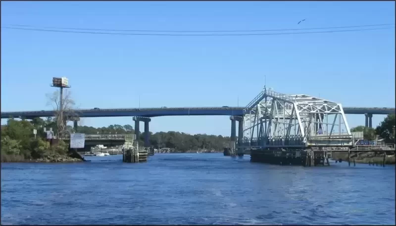
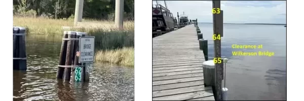
MM 132.4 Dowry Creek Marina. The ICW bridges are supposed to have a clearance at high water level (HWL), but many do not. One bridge in particular gives sailboats fits, the Wilkerson Bridge at MM 125.8 at the southern end of the Alligator–Pungo Canal has a clearance that varies with the wind, there is no lunar tide. With many boats headed north, it's vital to know the bridge clearance before arriving to avoid idling or anchoring for hours on end, hoping the water level will go down. With a water level gauge at Dowry Creek Marina, you can call their number at 252-943-2728 in advance to determine if you have enough clearance to get through.
The photo shows a typical high-water event at the Wilkerson Bridge, where there is only 63 feet of clearance. That's tough if you have a 64 foot mast. The photo of the gauge taken on 5/8/2025 shows a happier time when the clearance was 65 feet.
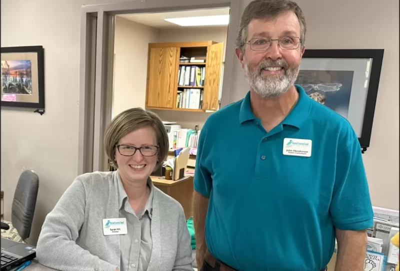
MM 27.9 Dismal Swamp Welcome Center. The canal is open for business! It's an alternative route vs going through Coinjock, but it's not for deep draft vessels. I've been through many times with my 5 foot draft, but have always heard a few "clunks". Nothing serious, just a few taps from small debris disturbed off the bottom. It's a scenic route and great fun to tie up at the free docks at the Visitor Center and in Elizabeth City. Sarah and John in the Visitor Center are ready to make your stay enjoyable.


- 4,000 Marinas
- Thousands of anchorages
- Updated Charts
- Mile-by-Mile Navigation
- Highlighted Alerts & Cautions
- Full-Color Aerial Photographs

The Waterway Guide App Makes it easy to leave reviews, use our explorer, and view waterway guide materials all on the go!